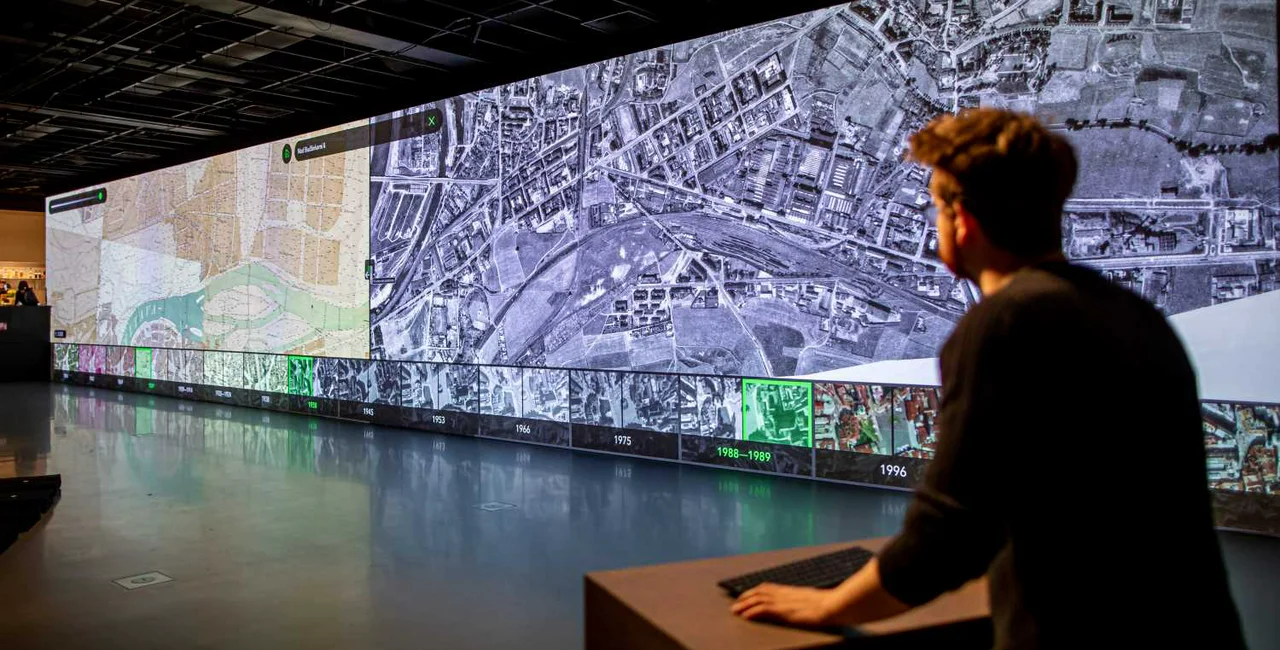
Prague has changed a lot over the past 200 years. A new interactive exhibition called Two Pragues: City from a Bird’s Eye View (Dvě Prahy: Město z ptačí perspektivy) in the Center for Architecture and Metropolitan Planning (CAMP). The exhibition uses plans and aerial photographs top show the development of the capital over the past 2000 years.
It runs until March 29 and is open to the public free of charge from 9 am to 9 pm every day except Monday.
People can explore their Prague neighborhood the early 19th century to the present. The oldest map in the exhibition is from 1816 and the latest from 2019, so visitors can easily see what their neighborhood looked like in the past or even a century ago.
Over the last 200 years, Prague has grown from 155,000 people to 1,309,000 and from 800 hectares to a total area of 49,605 hectares. In the last 100 years alone, their population has more than doubled. Significant differences can be seen the maps from the early 19th century compared to the latest ones, which show the development of industrial suburbs such as Karlín, Smíchov, Libeň or the establishment of the Malešice-Hostivař industrial area and a number of housing projects.
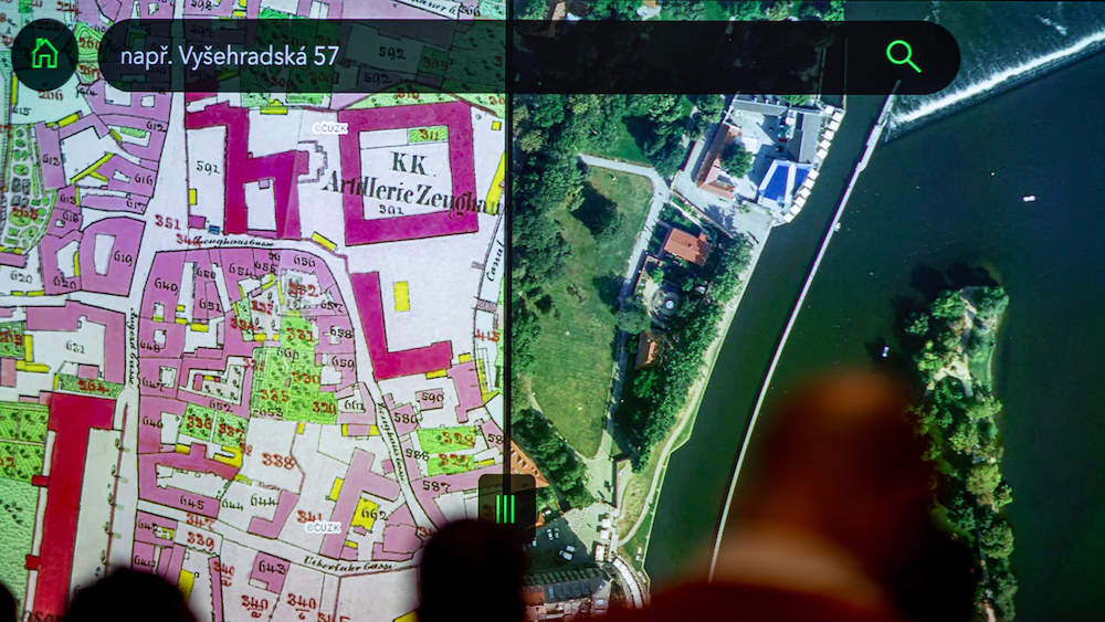
“Every Prague citizen can look for a street or a place of interest at the exhibition. All they needs to do is sit down at our station with a keyboard and mouse, choose a specific location and period and compare it to another historical epoch. All this can then be viewed on a 25-foot panoramic wall in overlapping layers of two maps. At the same time, the screens will also show other map applications that the Prague Institute of Planning and Development (IPR Praha) is currently developing,” Ondřej Boháč, director of IPR Praha said.
Visitors can explore places affected by the February 14, 1945, bombing, which hit over 2,500 Prague houses, including Palackého most, Palackého náměstí, Karlovo náměstí, and Vinohradská Street. By comparing the maps from 1945 and 1975, people can see how the city coped with the tragedy.
People can also see the transformation of Karlín. In addition to changing the character of Rohanský ostrov, the maps also show the shifting of the Vltava riverbed. “Paradoxically, we now perceive the sleek Vltava trough as immutable, as it has always been. But when we look at the old maps, we can see clearly how the river wildly made its way in the past and how much the riverbed was later regulated. It is also possible to see how land plots of individual districts changed, for example, between Holešovice and Karlín,” architectural historian Martina Koukalová from IPR Praha said.
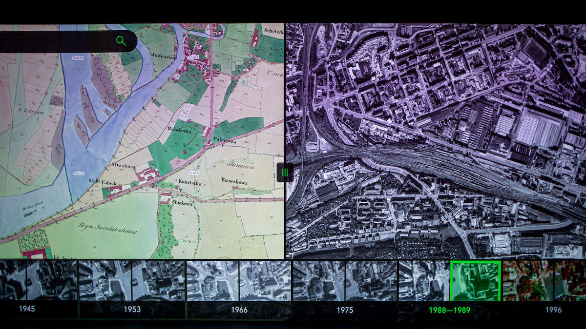
The city’s development is clearly demonstrated through the growth of housing estates in the 1970s. Through the post-war maps, the visitor can walk through the Jižní Město as a picturesque village or look at the awakening of the future southwestern part of the city and Barrandov housing project.
CAMP’s main mission is to improve the public debate on the development of Prague. It aims to be a source of clear and accessible information about the present and future of the capital for anyone interested in joint planning and development of Prague. CAMP also features an exhibition hall with a large-screen projection screen, a study room, a café, an outdoor terrace, and a lecture hall for public discussions,


 Reading time: 3 minutes