 Reading time: 2 minutes

Alongside the new HolKa footbridge that was officially opened to the public on Friday, Prague also unveiled the first part of a new system designed to help pedestrians navigate the Czech capital. The first Prague Walker pedestrian guide was inaugurated on the Holešovice side of the HolKa bridge this weekend.
Part of the city's Readable Prague (Čitelná Praha) project designed to simplify signage across the Czech capital, the Prague Walker maps aim to provide unified urban navigation for all types of mobility, with a focus on supporting sustainable movement within the city.

The recently unveiled HolKa footbridge, which connects Karlín and Holešovice with Štvanice Island and opens up new pedestrian travel possibilities within the city, served as an ideal location for piloting the new navigation concept.
"A new transport route has opened on the map of Prague, offering additional possibilities that the people of Prague will learn to use in their daily lives. It will replace various longer routes to work, to school, or to cultural activities," says Prague's Deputy Mayor for Transport Zdeněk Hřib in a press release.
"Our long-term goal is to simplify and clarify movement around the city, following our concept of a city of short distances, so that people can easily find services and strategic locations within walking distance of approximately fifteen minutes from their residence."
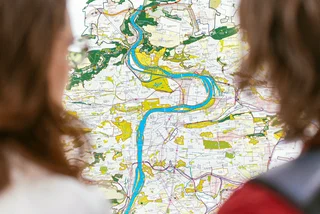
The project's focal point is the introduction of highly-visible obelisks, topped with an orange "Prague Walker" sign, which offer concise information about the surrounding area. These unique columns display maps of the immediate and wider surroundings within a walking distance of 5 and 15 minutes, along with directions to nearby points of interest.
The obelisks incorporate the pedestrian's perspective, allowing walkers to easily compare the map with reality. They are also designed to replace outdated street-level tourist maps within the city center.
"Walking around the city is an important part of healthy mobility and sometimes a surprisingly advantageous addition to public transport," explains Petr Tomčík, director of Prague Integrated Transport.
"That is why pedestrian navigation is also of great importance within the Readable Prague project, when we want to support sustainable methods of mobility in Prague and improve people's orientation and their information security, whether they are locals or visitors to the metropolis."

The new Prague Walker map at Holešovice is the first in a series of prototypes that will undergo user testing to gather feedback on their practical usability. The goal is to provide inclusive information for all user groups, ensuring accessibility, comprehensibility, and reliability.
The introduction of the Prague Walker navigation system is a significant step towards enhancing pedestrian movement and orientation within the city. By improving wayfinding elements, Prague seeks to alleviate crowded routes, promote sustainable mobility options, and enhance the overall experience for residents and visitors alike.
The gradual implementation of the Prague Walker guide map system is planned to begin in 2025, with pilot locations set up in various areas of the city over the course of the next year.