 Reading time: 4 minutes

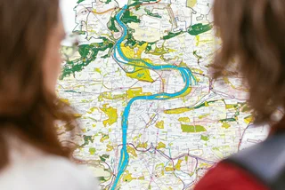
Praguers will begin to see new signs and information systems in public transit and on the streets of the capital starting this summer. After the pilot phase, the navigation system will be gradually implemented throughout the city starting in 2023.
Last year, ROPID (Regional Organizer of Prague Integrated Transport) announced an international competition for a cohesive information system to make it easier for people to navigate their way. In a two-round selection process, an international jury picked a Czech team consisting of the graphic studio Side2, atelier A69 architekti, and the typographic studio Superior Type. They were chosen from 16 teams evenly split between Czech and foreign entries.

The new system, called Legible Prague (Čitelná Praha), will unify all navigation elements in public spaces. Currently, eight entities oversee the city’s orientation system. Some signs differ between districts and also look different for buses, the metro, and trams. Prague wants to offer a new system that will be managed under one umbrella.
“Prague has a new, clear, and user-friendly citywide orientation and navigation system. I want everyone to be able to easily find information about their journey and not get lost unnecessarily. … Prague residents can look forward to elements with a modern look and new digital media and information,” Prague Deputy Mayor Adam Scheinherr, responsible for transport, said.
“The more transport options we offer in public transport, the clearer they must be. The key is clarity, good visibility, and up-to-date information. With quality design, Prague can finally compare with world metropolises such as New York or London,” he added.
The current navigation system has its roots in the 1970s and 1980s. The new system will take the best from it but be updated with modern technology and design
“We are planning big, beautiful projects such as metro D, new tram lines, the Smíchov Terminal, and a cable car from Podbaba to Bohnice. I cannot imagine that there would be an information system from the last century. … It's like putting a compass in your new car instead of satellite navigation,” Scheinherr said.

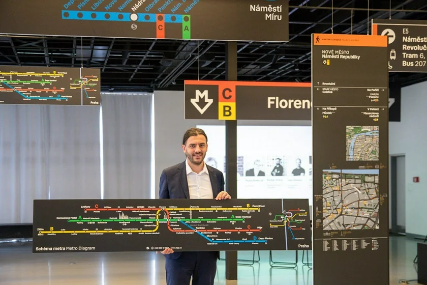
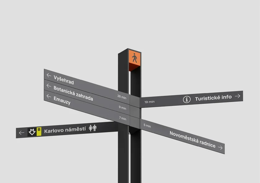
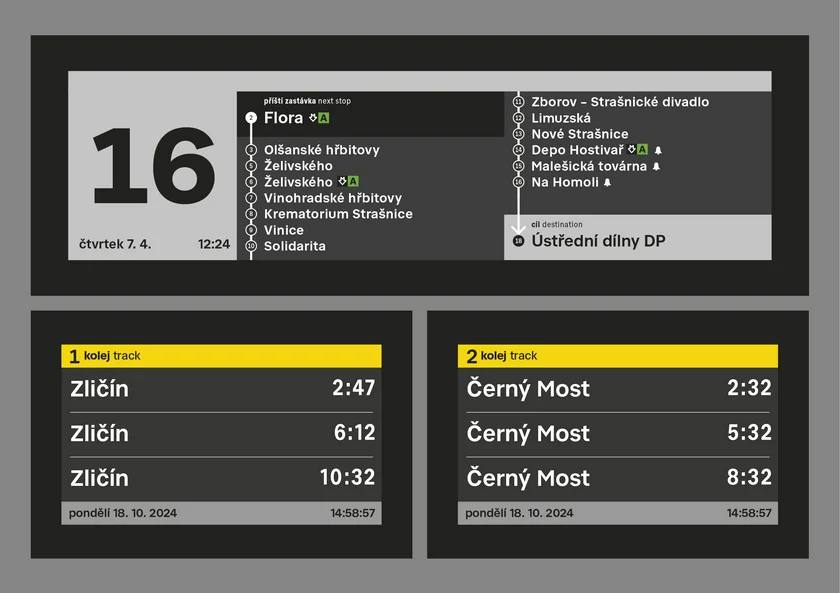
In the summer, people will see totems, obelisks, signposts for pedestrians, new graphics on signs in the metro, and completely new maps of the area.
“We are currently preparing a list of places where the pilot tests will take place, and we will also collect the opinions of passengers. We are also preparing exhibitions so that people can see the new system. … The feedback will help us to finalize the final form and functionality, especially of the new elements, which will be completely new for Praguers,” ROPID director Petr Tomčík said.
Petr Witowski, chairman of the board of directors and CEO of the Prague Public Transit Company (DPP), said some testing will occur this summer at the Háje and Palmovka metro stations. The entire replacement will take place as part of a natural exchange of old elements with new ones during renovations.
“The change of the information system will take several years. In the current difficult economic and political situation in Europe, we would consider it uneconomical to replace the entire information system at once,” Witowski said.
The nine-member international jury that selected the winner was chaired by Mike Rawlinson, founder of the Legible Cities initiative. He said the winning proposal was chosen unanimously.

“The proposal creates a very good impression. It does not compete with the city, but it can perfectly fit into it and become part of the overall identity of the city. … It is a system that helps pedestrians to move easily around the city and take advantage of everything the city has to offer,” he added.
The members of the winning team have already completed dozens of navigation systems for museums, schools, banks, hotels, residential projects, and multifunctional spaces.
Tomáš Machek from the Side2 studio said he had been talking with his colleagues for some time about Prague’s urgent need to update its navigation system.
“The current state of navigation, its lack of concept and fragmentation, has not pleased us for a long time. As soon as the competition was announced, we did not hesitate to apply. A bigger and more complex task in the Czech environment will not come along again,” he said.
Navigation systems don’t have room for exaggerated visual gestures. “It is necessary to organize the information and content in the right way, to deal with a multitude of details while maintaining a functional whole, and to pay attention to clarity,” Machek said.
The team researched urban navigation systems around the world and made a library of good examples. They also photographed and measured existing elements and supports in Prague and made models to verify the size relationships. “The system is well thought out and designed to serve the people of Prague for many decades to come, and to evolve as Prague continues to evolve,” he added.