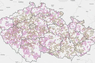
Abandoned mills, vanished villages and traces of the Iron Curtain are among the discoveries awaiting walkers using EPU, a free Czech hiking app highlighting places beyond the busiest tourist trails.
Its latest routes explore the Czech Forest, or Český les, along the Bavarian border in the Tachov and Domažlice areas. Developed with regional tourism organizations and conservation specialists, the trips combine countryside walks with stories about the borderland’s industrial and political past.
For international residents, there is a practical advantage: EPU is available in English. Its App Store listing also describes offline functionality, making it potentially useful in rural areas with unreliable mobile reception.
Old mills, border crossings and an Iron Curtain lookout
The Czech Forest routes offer several ways into a region where natural scenery and the remains of human settlement overlap.
A trail through the Hamerský Stream valley follows former ironworks and mills, showing how water once powered local industry. The educational route, just over two kilometers long, also passes a notable oak avenue and a roughly 250-year-old ash tree in Broumov.
Another trip, Branou do Všerubského průsmyku, explores the Všeruby Pass, a historic corridor through the border mountains that connected the Czech interior with Bavaria.
Around Panský vrch, walkers can discover a Jewish woodland cemetery with gravestones dating to the 17th century, mineral springs and a lookout tower reached by 207 steps.
A cross-border itinerary links the Schellenberg castle ruins in Germany with the lookout on Havran. At 894 meters, Havran is the highest peak in the northern part of the Czech Forest Protected Landscape Area.
Along the way are historic boundary stones, the Brotfelsen rock formation, remains of prewar Czechoslovak fortifications and sites connected with vanished villages. The surrounding landscape also carries traces of the Iron Curtain and the restricted border zone.
Regional tourism director Lenka Křížková said the area’s appeal lies partly in the opportunity to explore without crowds, alongside its viewpoints and borderland history.
A nature guide with games—and explanations of the rules
EPU offers hundreds of routes across Czechia, with trips selectable by length or type of activity. But its developers describe it as an interactive landscape guide rather than simply a map.
According to its App Store listing, users can collect virtual plant and animal species, read facts about them and test their knowledge through quizzes.
The app also provides notifications when users enter protected areas, explaining visiting rules and the reasons for restrictions or temporary closures. Its developers say it brings together information from Czech national parks and the Nature Conservation Agency, including alerts, events and trail closures.
A community section allows users to share photographs and route tips, report trail problems and organize activities such as group walks or volunteering. EPU is also available for Android through Google Play.
For conservation managers, directing walkers toward quieter routes is only part of the purpose.
Kateřina Juhaňáková of the Czech Forest protected area administration said visits need to be spread across both locations and seasons. The app should also explain why a place is sensitive, which species live there and how visitors can avoid disturbing them.
That gives the routes a different emphasis from a checklist of viewpoints: the mill remains, old boundary stones and wildlife become reasons to slow down and understand the landscape along the way.