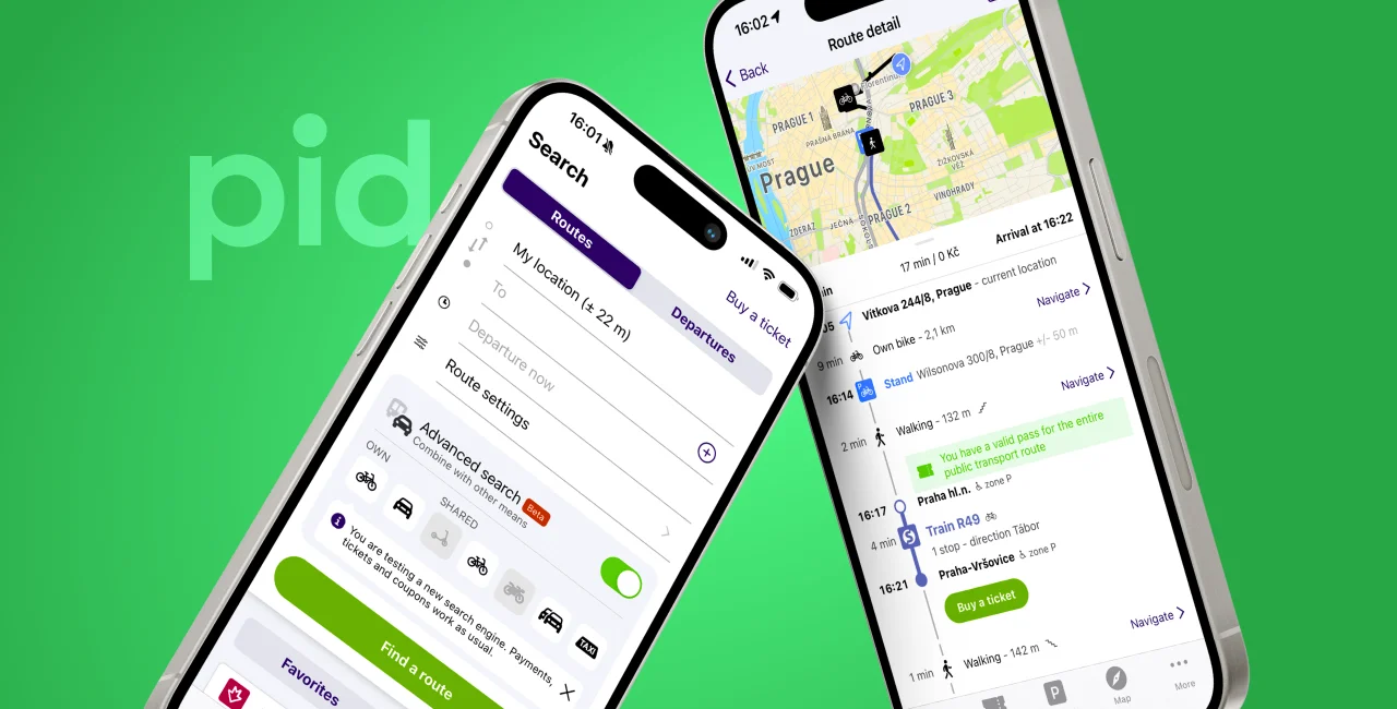
The PID Lítačka mobile application, used to buy transport tickets and plan public transport routes in Prague and Central Bohemia, has received a major upgrade that significantly bolsters its route-planning features and capabilities.
Various transport options in one journey
Users can now plan a journey from any two locations in the capital and surrounding area, rather than two separate public transport stops. The upgraded app also integrates walking routes to get to chosen destinations and outlines journeys made by car, bicycles (and shows people where to find shared cars and bikes), and taxis – differentiating it slightly from Google Maps. It can combine any mode of these transport options in one search, depending on a user’s preferences.
PARTNER ARTICLE
Benedikt Kotmel, chairman of the board of Operátor ICT, which operates and develops the PID Lítačka application, said: "Whereas the old app version just pasted information about the delay to a searched route, this one includes the delay in its selected search results, so it won't offer an overly delayed journey [compared to faster options].” Kotmel also said the new version has a “better logic and algorithm.”
Aplikace PID LÃtaÄka pÅ™edstavuje unikátnà vyhledávaÄ tras nové generacehttps://t.co/zIo9CCqFnL pic.twitter.com/f0f7cnRMJH
— PID (@PIDoficialni) May 3, 2024
Buy tickets in-app, search for step-free access
As before, the app will show current and planned maintenance work or closures on lines on the Prague Integrated Transport (PID) network. It will also show a map of Prague’s cycle network and paths.
Users have the option to specifically search for public transport vehicles with ramps and air conditioning, barrier-free stops at stations, and step-free access. Users can also locate stations with functional escalators and elevators. For those planning to cycle, they can indicate a preference to avoid steep inclines.
The new version of the app, which has been available to a small group of beta testers since January, also says whether a parking lot is full. As well as offering the option to buy short- and long-term transport tickets, users can also buy parking tickets with PID Lítačka.
Kotmel added: "We are continuously incorporating user feedback to make the search engine as efficient and widely used as possible." The PID Lítačka application currently boasts a record number of users, with around 900,000 people in Prague and the Central Bohemian region using it every month. People have collectively used the journey-planning search tool around 21 million times in the last year, Kotmel says.


 Reading time: 2 minutes