 Reading time: 2 minutes

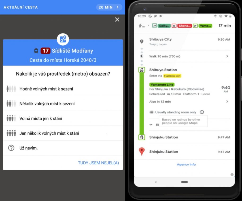
Google Maps has started showing its users information about how full
the Prague metro and other means of public transport means are, and
whether seats are likely to be available. The service relies on input
from the public.
The new feature is
called Obsazenost spoje (Occupancy Connections) “The function has
been available to Czech users since last Thursday (June 27),”
Google communications manager Alžběta Houzarová said in a press
release.

As it was just
introduced, so far the information is a bit sparse for most lines. On
a smartphone, four standing figures are shown, and shaded darker to
show whether the particular vehicle is crowded, similar to a star
rating for films or restaurants. Google also has launched a similar
service in Brno, South Moravia.
Current information
will come directly from travelers who have chosen to share it on
Google Maps. Google will automatically ask them if they were riding
this route and how busy it was. It uses not only up-to-date data, but
also historical traffic data.
The service is combined with information from public transit organizer Prague Integrated Transit (PID) for both Prague and Central Bohemia, which began to be used in January.
With the PID data, the map should be able to show exact connections, transfers, departure times, delays including current interruptions and detours, and more. The price of tickets is also shown. But it does not show if trams are air-conditioned or not.
Information from online sources should always be taken with caution, and no app can take into account unforeseen circumstances. Crowd-sourced apps also only work if people participate.
Google Maps recently in the US state of Colorado offered people a detour to Denver International Airport, to avoid a traffic jam on the regular route. Unfortunately the detour was a dirt road suitable only for four-wheel-drive vehicles, and wet weather made it worse. Hundreds of drivers found themselves stuck in the mud between other trapped vehicles and were unable to go forward or back.

Google said that the
road was not listed as private property, and nobody had reported it
as being closed.